
VI. Tapolca Rockwool Trail 8 / 14 km / 22 / 33 / 45
The race has ended.
The next race is expected on July 3, 2027 (Saturday), if it is held on the first Saturday of the month, like before. This is for information only, as the official race announcement is not available yet.
If you want to be notified as soon as the new announcement is available on our site, subscribe to our weekly newsletter. It will be included along with many other races.
Distances & start times
- 8 km 10:00 183 m D+
- 14 km 09:30 416 m D+
- 22 km 09:00 788 m D+
- 33 km 08:30 1132 m D+
- 45 km 08:00 1565 m D+
About the race
This information is indicative; the official race announcement always prevails and is available through the links above.
Location
Race location: Tapolca, Szabadság u.1.Csobánc művelődési ház

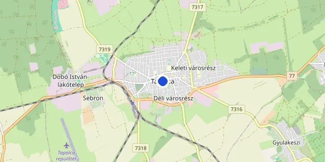
Choose a distance to show its route.
Route and elevation profile
Select a distance to see its elevation profile and aid stations here.
The route could not be loaded right now. Please try again later.
Elevation profile
- Measured length
- 8.2 km
- Elevation gain
- 183 m
- Elevation loss
- 184 m
- Highest point
- 250 m
- Lowest point
- 121 m
- Max. gradient
- 17%
Source: the organiser’s GPX file · loop course, arrows show the direction
- Measured length
- 14.0 km
- Elevation gain
- 416 m
- Elevation loss
- 418 m
- Highest point
- 366 m
- Lowest point
- 121 m
- Max. gradient
- 25%
Source: the organiser’s GPX file · loop course, arrows show the direction
- Measured length
- 23.3 km
- Elevation gain
- 788 m
- Elevation loss
- 789 m
- Highest point
- 366 m
- Lowest point
- 121 m
- Max. gradient
- 25%
Source: the organiser’s GPX file · loop course, arrows show the direction
- Measured length
- 33.8 km
- Elevation gain
- 1 132 m
- Elevation loss
- 1 132 m
- Highest point
- 366 m
- Lowest point
- 120 m
- Max. gradient
- 25%
Source: the organiser’s GPX file · loop course, arrows show the direction
- Measured length
- 45.7 km
- Elevation gain
- 1 565 m
- Elevation loss
- 1 566 m
- Highest point
- 454 m
- Lowest point
- 120 m
- Max. gradient
- 28%
Source: the organiser’s GPX file · loop course, arrows show the direction
FAQ
Recommended races



Enjoying futoversenyinfo.hu? Support development for the price of a sports drink or a gel.
☕ Support us