
 Ötpróba
V. Balatonszárszói Télapó Futás
Distances & start times
- 1,5 km 16 m D+
- 5 km 46 m D+
- 10 km 70 m D+
- 21 km 173 m D+
About the race
Zárd az évet a legjobb futóarcokkal, akik most egy napra Télapó, Krampusz, Rudolf vagy éppen Kismanó ruhában pörgetik a kilométereket a legbulisabb balatoni szezonzárón!
Villámgyors aszfaltpálya: suhanj egyéni csúccsal a karácsonyi hajrában Szárszótól Zamárdiig, manó távtól a félmaratonig megtalálod a Neked való decemberi futócsemegét!
A nevezési díj tartalmazza:
A versenyen való részvételt egy gyönyörű balatoni pályán sok-sok lelkes Télapófutó társaddal
Rajtcsomagot,
400m, 1500m: ajándék RunTime Balaton tornazsák
5km, 10km, 21km: választható ajándék: RunTime Balaton tornazsák vagy egy palack Gutman bor (utóbbi csak 18+)
Rajtszámot
Chipes időmérést
Online eredménylistát
Gyönyörű, egyedi befutóérmet
WC és öltöző használatot (mindegyik fűtetlen!)
Ruhatár használatot (értékmegőrzés nincs)
Bőséges frissítést a kijelölt frissítőpontokon
A helyezettek díjazását
Közös profi bemelegítést
Egészségügyi felügyeletet
Ingyenesen profi letölthető fotókat
Gondosan kijelölt útvonalat és útvonalbiztosítást
Letölthető digitális oklevelet
Ingyenes parkolást
Expected weather on race day
Average of past yearsThis information is indicative; the official race announcement always prevails and is available through the links above.
Location
Race location: Balatonszárszó, Központi Strand


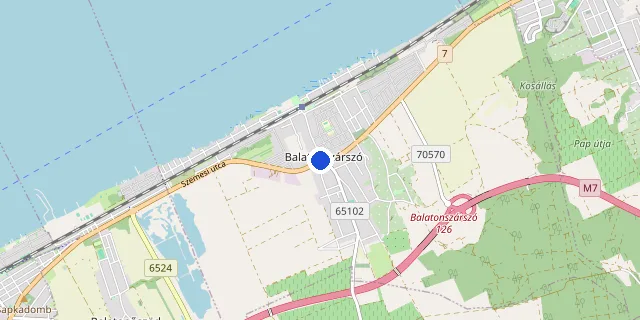
Choose a distance to show its route.
Route and elevation profile
Select a distance to see its elevation profile and aid stations here.
The route could not be loaded right now. Please try again later.
Elevation profile
- Measured length
- 1.5 km
- Elevation gain
- 16 m
- Elevation loss
- 17 m
- Highest point
- 107 m
- Lowest point
- 93 m
- Max. gradient
- 3%
Source: the organiser’s GPX file · loop course, arrows show the direction
- Measured length
- 5.1 km
- Elevation gain
- 46 m
- Elevation loss
- 45 m
- Highest point
- 110 m
- Lowest point
- 93 m
- Max. gradient
- 4%
Source: the organiser’s GPX file · loop course, arrows show the direction
- Measured length
- 10.3 km
- Elevation gain
- 70 m
- Elevation loss
- 70 m
- Highest point
- 119 m
- Lowest point
- 93 m
- Max. gradient
- 6%
Source: the organiser’s GPX file · loop course, arrows show the direction
- Measured length
- 21.4 km
- Elevation gain
- 173 m
- Elevation loss
- 174 m
- Highest point
- 120 m
- Lowest point
- 91 m
- Max. gradient
- 7%
Source: the organiser’s GPX file · loop course, arrows show the direction
Target time planner
Distance
Elevation gain: +173 m D+
Target time (h : m : s)
Average pace on this course
6:00 /km
The elevation gain adds +27 s/km, on a flat course this equals a 5:33 /km pace.
Pace band for this race → Full pace calculator → Splits calculator →
FAQ
Recommended races




Enjoying futoversenyinfo.hu? Support development for the price of a sports drink or a gel.
☕ Support us