
All editions of this race
2
distances
940-1033m
elevation gain
Distances & start times
- 21,2 km 940 m D+
- 30 km 1033 m D+
About the race
30 kilométer az egykori visegrádi római őrtoronytól, a szentendrei belvárosig a Visegrádi-hegység legszebb (és legnehezebben járható) részeivel.
Entry fee
Race website
Add to calendar
5 000 HUF
This information is indicative; the official race announcement always prevails and is available through the links above.
Surface
Trail
Location
Race location: Visegrád

© OpenStreetMap
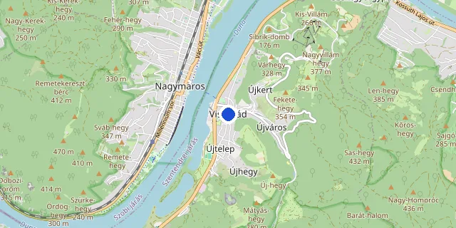
Choose a distance to show its route.
Route and elevation profile
Choose a distance
you can pick more than one
21,2 km
↑ 940 m max. 556 m no aid stations
GPX 99 KB , download the 21,2 km route
30 km
↑ 1 033 m max. 560 m no aid stations
GPX 119 KB , download the 30 km route
Select a distance to see its elevation profile and aid stations here.
The route could not be loaded right now. Please try again later.
Elevation profile
- Measured length
- 21.2 km
- Elevation gain
- 940 m
- Elevation loss
- 938 m
- Highest point
- 556 m
- Lowest point
- 195 m
- Max. gradient
- 51%
Source: the organiser’s GPX file · loop course, arrows show the direction
- Measured length
- 29.6 km
- Elevation gain
- 1 033 m
- Elevation loss
- 1 093 m
- Highest point
- 560 m
- Lowest point
- 110 m
- Max. gradient
- 38%
Source: the organiser’s GPX file · point-to-point course, arrows show the direction
FAQ
Salomon Visegrad Trail 2026 takes place on May 23, 2026 at Visegrád (Pest county).
The race takes place at: Visegrád, Pest county.
Salomon Visegrad Trail 2026 offers the following distances: 21,2 km, 30 km.
Yes, the GPX route of these distances can be downloaded in the “Route and elevation profile” section: 21,2 km, 30 km.
All details are on the official race website. Open official website →
Let us know via the “Wrong info? Report it” button at the bottom; we review and fix it.
Recommended races



Enjoying futoversenyinfo.hu? Support development for the price of a sports drink or a gel.
☕ Support us