
Futapest Várgesztes terepfutás 2026
About the race
Eredményhirdetés és sorsolás: 13:30
Előnevezés október 19-től
Pálya: földút, a hosszú távnak van egy 1 km-es aszfaltút közben, oda és vissza is. Frissítőállomás: 3.5 és 10.5 km-nél
Az erdőlátogatás szabályai:
1. Az erdőben ne hagyjatok szemetet, legfeljebb a frissítőállomáson, azt összegyűjtjük.
2. Az afrikai sertéspestis terjedését megakadályozandó tiszta, fertőtlenített cipővel induljatok.
3. Napnyugta és napkelte között ne legyetek az erdőben, mert vadászatba ütközhettek.
Weather forecast
Meteorological forecastThis information is indicative; the official race announcement always prevails and is available through the links above.
Location
Race location: Várgesztes, Faluház,Arany János utca 55/B


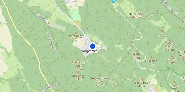
Choose a distance to show its route.
Route and elevation profile
Select a distance to see its elevation profile and aid stations here.
The route could not be loaded right now. Please try again later.
Elevation profile
- Measured length
- 5.0 km
- Elevation gain
- 128 m
- Elevation loss
- 128 m
- Highest point
- 385 m
- Lowest point
- 268 m
- Max. gradient
- 27%
Source: the organiser’s GPX file · loop course, arrows show the direction
- Measured length
- 16.0 km
- Elevation gain
- 402 m
- Elevation loss
- 402 m
- Highest point
- 431 m
- Lowest point
- 262 m
- Max. gradient
- 27%
Source: the organiser’s GPX file · loop course, arrows show the direction
Target time planner
Distance
Elevation gain: +450 m D+
Target time (h : m : s)
Average pace on this course
6:00 /km
The elevation gain adds +79 s/km, on a flat course this equals a 4:41 /km pace.
Pace band for this race → Full pace calculator → Splits calculator →
FAQ
Recommended races




Enjoying futoversenyinfo.hu? Support development for the price of a sports drink or a gel.
☕ Support us